Zee Media Bureau
New Delhi: The monster snowstorm that hit eastern United States on January 23rd, 2016, has paralysed the capital city of New York and the entire East Coast and has left at least 17 dead.
US space agency NASA was the first to issue a warning about the approaching East Coast blizzard.
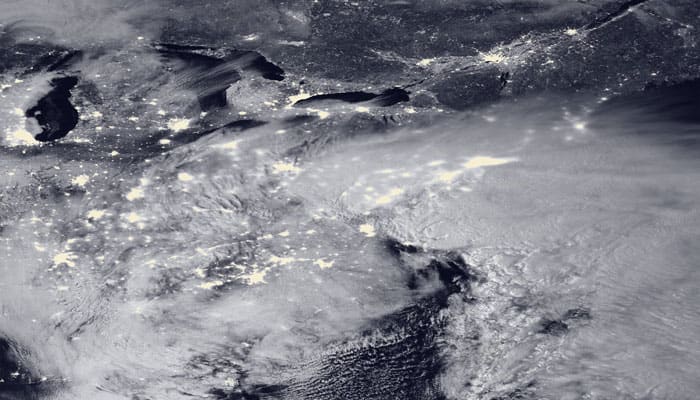
Now, NASA has released an image of the blizzard that was acquired through the Visible Infrared Imaging Radiometer Suite (VIIRS) on the Suomi NPP satellite, which shows the storm system at 2:15 am EST on January 23rd.
In the image, according to NASA, the clouds are lit from above by the nearly full Moon and from below by the lights of the heavily populated East Coast. The city lights are blurred in places by cloud cover.
As per NASA estimates, snow totals have topped 30 inches in at least four states, and at least 12 inches have been recorded at locations in eight states, with many more hours left to the storm. Snowfall rates reached as high as three inches per hour, and blizzard warnings were in effect from Virginia to Massachusetts through Jan. 24. As of 2:30 p.m. EST on Jan. 23, the National Weather Service reported snow totals of 40 inches in Glengary, W.V., 33 inches in Frederick, Md., 23.5 inches at Dulles Airport near Washington and 16.2 inches at the National Zoo in Washington.
The image was composed through the use of the VIIRS “day-night band,” which detects faint light signals such as city lights, moonlight, airglow, and auroras.


